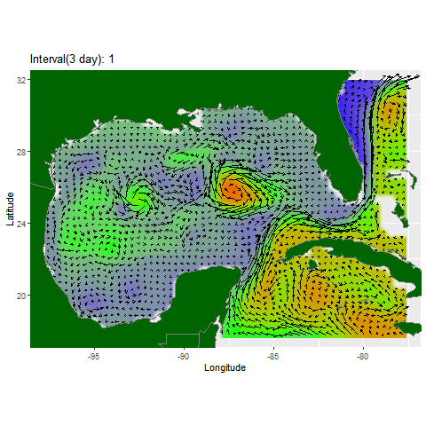
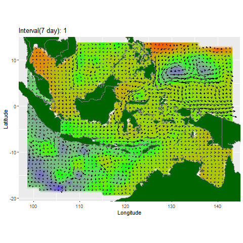
I have been analyzing HYCOM’s water velocity data to develop a method for visualizing water movement, specifically to identify potential upwelling phenomena. I have devised a format that utilizes vector arrows to represent water velocity and a raster to depict water elevation. I have successfully implemented a script that generates animated visualizations for any desired location and time.
If you would like this animation at a specific time and place, send me an email. Or, you can easily gather the data needed to make a similar plot using this package that I have created.